Yachting Monthly June 1990
IN THEORY, the larger and more weatherly yacht should get in more sailing than a smaller boat. This may well be true for craft kept in man-made harbours or marinas on open coasts with few other havens, but among the wide estuaries the small boat will give her owner many more hours’ sailing. When strong winds rule out sailing at sea the small boat can take advantage of her shallow draught and general handiness to explore within the estuary.
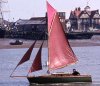
The 16ft gaff cutter Shoal Waters found herself weatherbound recently at Wells on the north Norfolk coast together with two larger visiting Yachts, one waiting to return to Boston and the other to the Humber. For them, the strong northerly winds on the Tuesday killed any thoughts of getting under way, but I knew that at least I could get some interesting sailing within the harbour itself. The impending classic boat rally at Shotley in a fortnight meant that we must soon head south, but Tuesday brought very strong winds from the north.
I persuaded Joy to take the bus home, leaving me free to sail in heavier conditions than she could tolerate, suffering as she does from seasickness. While trapped here in 1973, after a visit to Whitby, l had found that it was probably possible to get out through the extensive marshes to the east towards Blakeney, but had not actually done so. A chat with a canoeist while waiting to dry on Monday afternoon had confirmed this but he said that there were two foot-bridges. He also mentioned that the sand outside the harbour, east of the main entrance, had built up considerably, making it a long trip out of Wells round into Blakeney. Thus the ‘back door’ was worth a look for it could shorten the passage home and save on harbour charges.
I decided to sail as far as possible through the maze of creeks to the north-east and then dry out so that I could explore further on foot when the tide had gone. Low water neaps was on Monday and they started making up today. As soon as Shoal Waters floated I set off with one reef to explore the creek which runs due east above the town. There was little water, though, and I soon nosed up into the northern weather bank and anchored for an hour. The wind increased steadily and the 1400 forecast gave Humber north-west Force 6-8 with a gale warning. I close-reefed the main and set the storm jib, a tiny sail of just 12sq ft.
Many local yachts have moorings in a wide creek that runs east of north just above the commercial harbour. I reached back to this creek and came about to find I could just point through the moored craft to the narrow and shallower deserted creeks beyond. Some stretches were dead to windward and meant short sharp tacks but there was bags of tide going my way. At each of the many junctions I had to take a quick choice but my standard rule for such exploration – that following the tide will take you further in and bucking it will bring you out (provided you reverse it at High Water) – stood me in good stead once again.
The roar of the surf on the outer bank grew louder but I was unable to see anything of it as the saltings are fringed with grass covered sand dunes and low scrub. Gradually the creek bore south-east and I wondered if I would merely end up along the southern mainland shore again. The fair tide eased and now seemed to be flowing against me. Was this the start of the ebb or was I over the watershed and meeting the tide flowing in from the sea? I had found no bridges, although rotting posts in two places showed where they may once have been. Suddenly the channel swung sharply to windward to reveal a frightening sight. Beyond the 200 yards of salting fringed creek was a wall of surf 10 or 12ft high. Yet the water sweeping into the creek was smooth!
It dawned on me rapidly that the gleaming white surf was breaking on a bank some quarter of a mile away. The water between stood out strangely smooth and black and was flecked with lumps of brownish foam that raced towards me. The tide was almost level with the saltings and, as the foam reached them, the screaming wind lifted it off the water so that it tumbled on over the coarse vegetation for hundreds of feet. The tide flooding into the creek was too strong to beat over so I swung the boat in against the saltings on the western edge and anchored to explore further on foot. Soon, though, I found my way barred by a gut too wide to jump. My glasses revealed a couple of sand and shingle banks to the east marked off with stakes and string as bird nesting areas and a few craft moored far off against the shore, presumably at Stiffkey.
It was 1520, a few minutes from High Water. By 1540 the tide flooding into the creek had eased and I tacked out just beyond the saltings to anchor in three feet, marvelling at the smoothness of the water. I was tempted to sail on to see if there was a clear channel eastward behind the surf but discretion ruled the day. Far better to dry out where I was to ‘look see’ when the water had gone. The tide fell very slowly indeed, presumably because the water had difficulty in getting off the sands into the teeth of the howling wind.
It was 1645 before she grounded and took another hour to dry, by which time the water in the creek had changed direction and was flowing back towards Wells Harbour. The 1800 forecast gave Humber north-west Force 4-5 and Thames NNW Force 5-6 going 3-4. In glorious evening sunlight I walked along the sands as the water retreated. I found that after a couple of hundred yards my channel turned east, to run parallel to the massive sand on which the surf had been breaking when I arrived. After about a mile it swung north again to dive into the surf.
Where it turned towards the sea, another channel continuing eastwards could be seen beyond a narrow sand bar.
Next day, I was to learn from a bait digger that this had once been the route of my channel which had continued eastward behind the sand spit to join up with another from Stiffkey before entering the sea. Recently it had turned north to find its own way out. He was a member of the lifeboat crew and came up with the useful information that, when towing in rescued craft, they often came into Stiffkey because there was much less surf on the bar there than at either Wells or Blakeney. (Presumably the exit to my channel would enjoy the same advantage.)
I watched the sun go down over the sands before settling down to sleep ready for an exciting early start. I had already repositioned my anchor so that once I floated next morning I could retreat into the saltings under headsails if necessary.
Wednesday 0140: No sign of water in the creek but plenty of noise from the advancing surf and a bitterly cold wind.
0200: No change but surf louder.
0235: Still no water! Dozed again wondering if I might be neaped.
0300: Water in the bottom of the channel at last. Smooth as silk but the gale seemed wilder than ever. I got dressed as the tiny cabin warmed rapidly from the heat of the stove and the radiant heater. The first signs of dawn were already in the eastern sky as a tired old crescent moon rose above the horizon. I made tea, then refilled the hot water bottle and put it back in the sleeping bags for I had not done with them yet. After dressing with two sweaters and topping off with scarf and duffle jacket (this was no time for artificial fibres), I settled on to the bridgedeck with my feet inside the cabin and elbows on the cabin top to watch events. The radio reported extensive frost inland. I thought of my only neighbours, several oyster catchers sitting on their eggs, and reflected that it must be a cold old job.
0320: Nearly afloat. Calculated the time of High Water at 0335. This is a very different tide to that of yesterday afternoon – at least 2ft lower. In the sober light of dawn it became obvious that the wind was much lighter.
0335: Boat afloat at last. Shortened chain so that she middled the channel. Flood tide seemed to be slackening already.
0410: Tide ebbing although much of the sand spit and wide bay to the west that was covered yesterday was still dry. Decided to sail out along the creek. The first hundred yards was dead to windward and as it was too narrow and shallow to beat, I removed my trousers, and waded out, leading the boat by the bowsprit into deeper water until I could sail. Five minutes later I anchored at the limit of calm water, south of where the sand spit dived into the surf, and crawled back into my sleeping bags to thaw out. I left the radio on for the 0600 forecast but dozed over it.
0650: I looked out to find the spit had grown half a mile eastward leaving a much narrower channel. I was in 2ft of water and obviously on the northern side so I got the anchor an I let her drift south into 4ft The local waters forecast at 0700 on radio Three gave westerly Force 4 as far south as the Wash and north-west to west Force 4 from there to North Foreland.
0730: Shoal Waters grounded on golden sand in the middle of the channel. Twice during the forenoon I tramped over the sands to study the entrance. The last of the ebb went out very fast, hitting the surf in an horrendous jumble of water. l decided that it might be possible to get out through the surf on the flood as then the water would be going in the opposite direction and, hopefully, would be very much quieter. The new entrance/exit was comparatively narrow with a shoulder of sand on the western side and a gradual slope to the east. Provided I got there before it covered, this shoulder of sand on the western edge should give me a good guide to the best water. The wind had swung more westerly which should bring it on the beam as I hit the surf and as the tide would run in hard, I decided to carry full sail. It was worth a try!
Another attraction of this plan was that I would catch the first of the eastgoing tide along the coast which starts about two hours before High Water. This is usually very difficult to achieve under sail from the main entrances to Brancaster, Wells or Blakeney for when the wind is fair for the 50-mile trip to Yarmouth it will normally mean beating over the strong flood tide.
1200: No sign of the returning tide. Waiting is always worse than doing.
1235: First signs of returning tide in the channel.
1300: I was afloat and got away with full sail. It was difficult to steer on the run at first, as I could not lower the rudder blade in the shallow water, but the problem eased as the water deepened. With half-rudder and half-plate, trousers off ready in case it was necessary to go over the side either to save the boat or even myself, and the water just level with the top of the sand to port, she handled the popple in the channel easily.
As I had anticipated, the advancing surf lost its fury on the swiftly flooding tide, much as a boxer’s furious punch falls lightly on an opponent moving smartly backwards. In fact, she has often met worse in the Ore or Deben but beyond were three solid lines of advancing surf. She reared up over the first two, which were not breaking, but the third was like an advert for washing powder and the showers of spray came right over the boat. Then it was open water, albeit a little confused, as I eased away to the north-east to keep well clear of the tide sweeping into Blakeney.
The rest was routine. I put in one reef but soon shook it out. The wind went north-west and then north which meant that the headsails were useless most of the way. When I reached Yarmouth at 2200, it was just too late to catch the last of the flood in (no engine) and I had to anchor south of the mole until 0315. This wasn’t much fun, but then if you can’t take a joke don’t take up sailing!